GEORespectApplied geomorphology as an essential tool for smart land-use planning and development

Motto: Safe and considerate utilization of the landscape lies in respect for the natural processes that shape it.

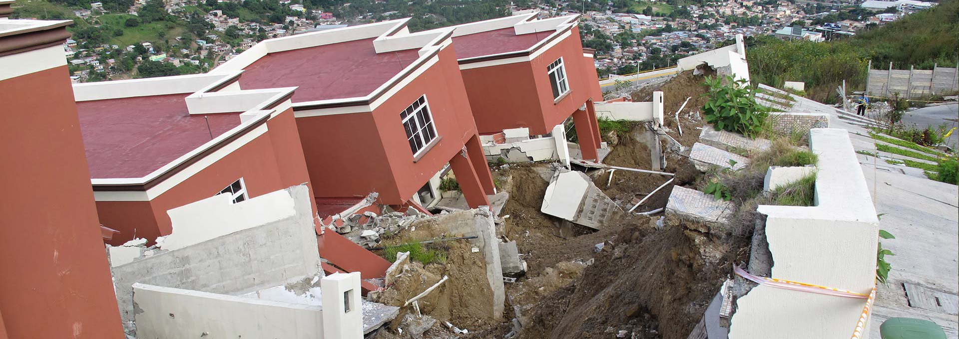
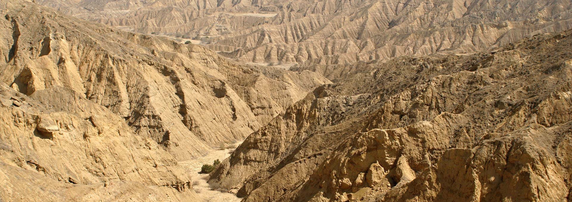
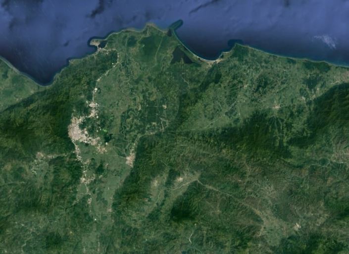
Major part of human activity is bound to the surface or its immediate surroundings. This means that the nature of the earth's surface (morphology, geology, land cover etc.) and processes it creates have an immediate impact on human activity and the manner of land use. It follows that understand the evolution of the earth's surface is essential prerequisite for its effective and environmentally considerate use.


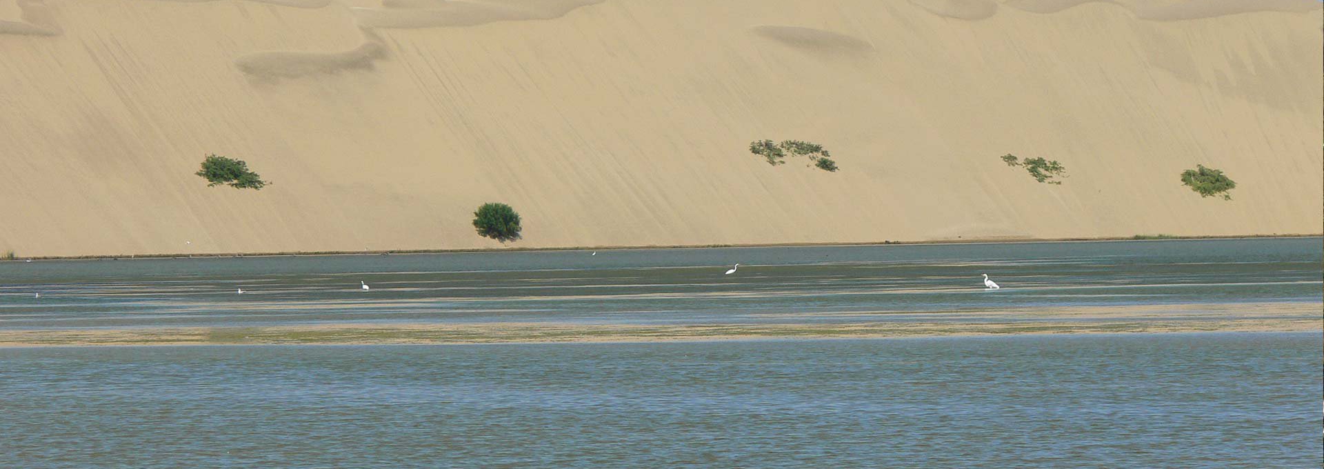
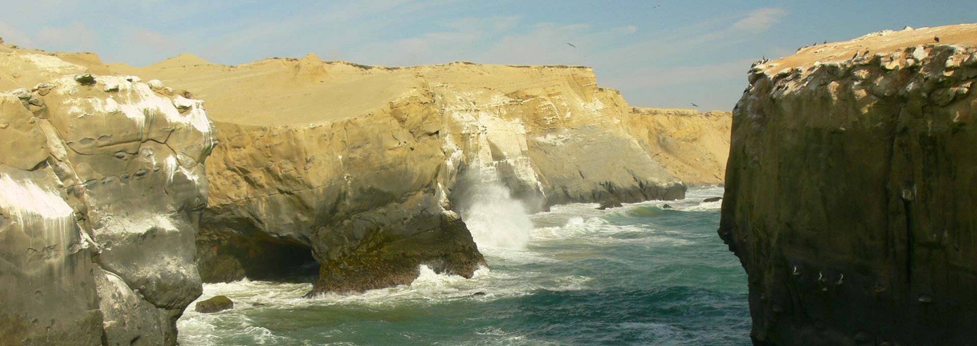
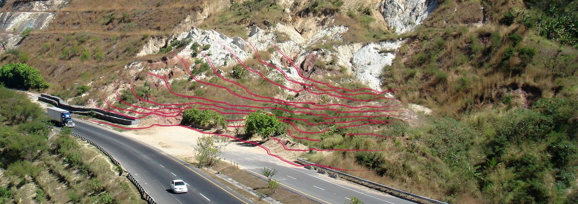
NEWS: GEORESPECT s.r.o. has been  currently solving a feasibility study project with the topic “USE OF APPLIED GEOMORPHOLOGY IN THE EVALUATION OF LANDSCAPE VULNERABILITY BY NATURAL HAZARDS ASSOCIATED WITH THE CLIMATE PHENOMENON EL NIÑO IN THE REGIONS OF NORTHERN PERU“ supported by the Czech Development Agency and Ministry of Foreign Affairs of the Czech Republic in frames of the programme Czech International Development Cooperation.


Geomorphological terrain analysis

Characteristics of geomorphological terrain analysis

Geomorphological terrain analysis is based on the demarcation of individual landforms, and the assessment of its formation and approximate age. The analysis is based primarily of the interpretation of a digital terrain model. This study can be supplemented with terrain documentation or the evaluation of satellite and aerial images.

Dynamic geomorphological map as an output of geomorphological terrain analysis

The dynamic geomorphological map represents a generalized image of the area development. Circumscribed landforms are subsequently divided into groups specified by their origin: i) structural and tectonic landforms, ii) landforms of denudation, iii) landforms of accumulation, iv) anthropogenic landforms. Individual landforms are drawn on a suitable map base in a form of polygons, lines and eventual marking points. The scale of the map affects the extent of detail.

Practical use of the geomorphological terrain analysis

The results of the geomorphological terrain analysis serve as a basic data needed for analysing the vulnerability of the territory by natural processes such as floods, erosion, landslides, earthquakes, etc..

Analysis of natural hazards

Evaluation of the vulnerability of the territory by natural processes

The expanding urbanisation of the countryside and the infrastructure development is the cause of incessant interaction between human activity and various natural processes. Underestimation of an impact of this interaction can result in extensive damage such as landslide, floods or earthquake, etc.. The importance of the analysis of the vulnerability of the territory lies in localization and characterization of those natural processes that present an acute or potential hazards.

The use of natural hazards analysis

Prevention – making use of the outputs in order to create new spatial plans, environmental plans, developer and construction projects, and plans for civil defence

Solution of current problems – making use of the outputs in order to propose remedial and security measures that would reduce the danger of soil erosion, landslides, floods, etc..

References

GEOLOGICAL AND HYDROGEOLOGICAL MAP COMPILATION ON A 1:1,000,000 SCALE FOR THE ENTIRE TERRITORY OF ETHIOPIA

2020 - 2022

GEORESPECT como subcontrator del Servicio Geológico Checo implementa las siguientes actividades dentro de este proyecto:

  • Desarrollo de una base topográfica para el mapeo geológico a escala 1: 750.000 del territorio del país de Etiopía;
  • Análisis morfo-tectónico del territorio del país de Etiopía a  escala 1: 750.000.

El proyecto está financiado por la Agencia Checa de Desarrollo.

ANÁLISIS DE LA VULNERABILIDAD DE LA CUENCA BAJA DEL RÍO PIURA POR LAS INUNDACIONES Y LA POSIBILIDADES DE SU ELIMINACIÓN (UN PROYECTO PILOTO DE EL ANÁLISIS DE LA VULNERABILIDAD DEL PADESASTRES NATURALES EN EL PERÚ)

2018 - 2019

El tema del proyecto fue analizar 2 500 km2 de la cuenca baja del Río Piura en términos de su vulnerabilidad a las inundaciones. La implementación incluyó:

  • Evaluación de los impactos del fenómeno El Niño 2017.
  • Estudio de susceptibilidad de la zona por las inundaciones una escala de 1: 25,000.
  • Propuesta de medidas para reducir la vulnerabilidad del territorio a las inundaciones.

El proyecto se ejecutó con el apoyo financiero de la Agencia Checa de Desarrollo.

Reporte preliminar de reconocimiento geomorfológico de las zonas afectadas por el fenómeno de El Niño en la cuenca baja de los ríos Piura y Chira

2017

Geomorphological map of the ETE - south area in scale of 1: 10,000 (Czech Republic)

2017

The subject of the contract was to create a geomorphological map of the southern part of the Nuclear Power Plant Temelín (32 km2) based on the analysis of digital terrain model. The basic aim of the analysis was to define geomorphological forms, units and to evaluate present exodynamic processes.

The GEORESPECT Ltd. made it as a subcontractor for the company AQUATEST under the contract "Evaluation of geological and other information on selected areas of the Czech Moldanubicum, in terms of potential suitability for the storage of nuclear waste in polygon ETE - South". The sponsor of this contract is the organizational structure of the Czech Republic - Radioactive Waste Repository.

Evaluation of the physical vulnerability of the Miramar-Vichayal territory (Piura region, Peru) for the agricultural project

2017

The aim of the work was to evaluate present exodynamic processes with a special focus on potential natural hazards (floods, erosion, landslides and salinization) on area of 12 000 ha. The outputs were geomorphological map, map of susceptibility of the territory to natural hazards and overview of safe areas for agriculture.

The work was produced for the private company Agroetanol Pacifico s.a.

Cartography and geomorphological evaluation of selected municipalities of Honduras for the Project "Disaster Risk Management" (PGRD)

2015 - 2016

The subject of the contract was to create a geomorphological maps of 14 selected municipalities of Honduras (approx. 7 000 km2) based on the analysis of digital terrain model. The aim of the analysis was to define individual landforms and to evaluate present exodynamic processes with a special focus on natural hazards.

The work was implemented as a subcontract for COPECO.

Contacts

Company: GEORESPECT Ltd.
Address: Kovářská 1414/9, 190 00 Praha 9, Czech Republic
Company number: 05894352
Tax number: CZ05894352
Legal form: Limited Liability Company
File number: C 272609 with the Municipal court in Prague
Data case: s9dei6f
E-mail: georespect@georespect.cz